Bridges, Barges, and Balance - Our ICW Challenge
- svkavalea

- May 14
- 4 min read
While our preference is to sail offshore, sometimes the weather just doesn’t cooperate. Case in point: rounding Cape Hatteras — known ominously as the "Graveyard of the Atlantic." To get around this notoriously dangerous point, we need a solid 36–48 hour window of fair weather. There’s no place to anchor and nowhere to duck in if conditions deteriorate. Once committed, you're all in.
On our last two transits around Hatteras, the weather aligned. This time, not so much. We were looking at a week-long wait in Morehead City, NC before any break in the offshore forecast. So we weighed our options and opted to go "inside" — taking the protected inland route via the Intracoastal Waterway (ICW). While this spared us the wrath of offshore conditions, it came with its own set of formidable challenges. Chief among them? Bridges.

The Bridge Clearance Balancing Act
The ICW is crisscrossed with bridges — some fixed, some opening, all potentially problematic for a sailboat like ours with a mast height of 63 feet 10 inches. Add another foot for our anemometer and wind vane, and a three-foot VHF whip antenna, and you’re looking at serious clearance concerns. The rule of thumb: we need low water to make it under bridges — but not so low that we risk running aground with our 4.5-foot draft. It’s a constant balancing act.
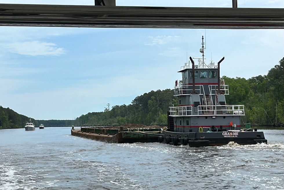
And it’s not just bridges. Navigation in the ICW is complex and intense: narrow channels, shifting shoals, unlit markers, massive barges, and unexpected debris like submerged logs. Every mile demands alertness and teamwork.
Tools of the Trade
Our planning toolkit is robust and well-rehearsed. We use:
Raymarine Axiom MFD with Navionics chip for our primary chart plotting
Garmin apps and handheld GPSMAP for mobile, backup navigation
Paper nautical charts for fail-safe redundancy
We rely heavily on community-sourced data:
Bob423 Tracks — GPS tracks by Captain Robert Sherer, the ICW guru
ActiveCaptain (by Garmin) — a goldmine of user-submitted info on bridge heights, anchorages, hazards, and more
Weather is another critical piece. We monitor:
NOAA marine forecasts
Windfinder and PredictWind Pro for wind and swell
Tide Times, Navionics, and NOAA tide tables
USGS stream stage (gage height) to assess water levels

And then there’s the oldest, most analog tool: sunlight. We only travel the ICW in daylight. Why? Let’s just say a nighttime grounding (and a call to Sea Tow) last season taught us that lesson the hard way.

A Test of Patience, Precision, and Perseverance
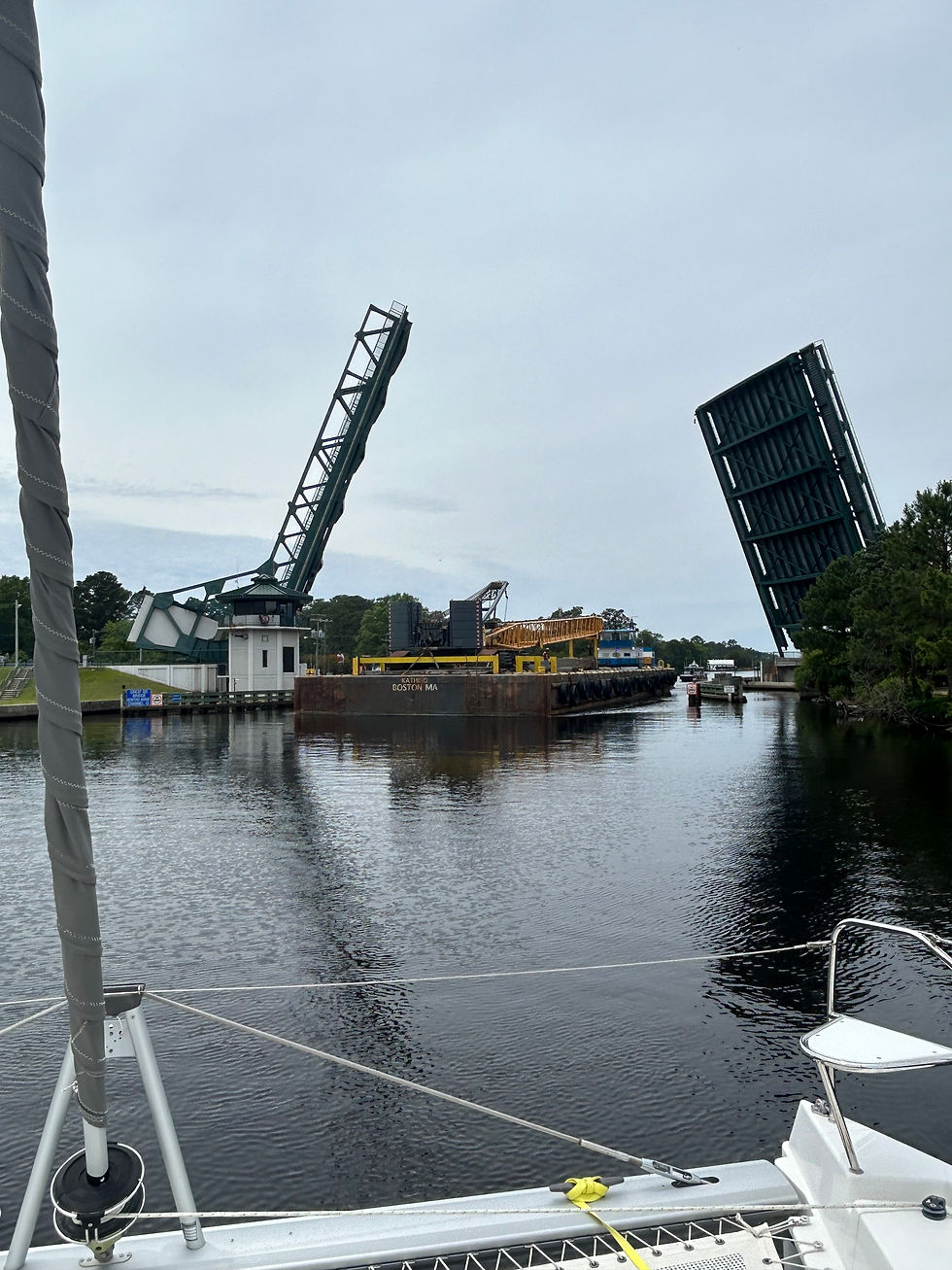
Sometimes, all the planning in the world isn’t enough. You may approach a bridge thinking the clearance is sufficient, only to find otherwise. Then it’s decision time: wait for the water level to drop, or turn around and try another route. For this recent passage from Morehead City to Norfolk, VA, we went under or through 21 bridges and one lock. It was an intense stretch.
Despite making it through the bridges, we had our moments:
Ran aground once, making room for a barge. Thankfully, we got off quickly — with the barge bearing down on us.
Hit two submerged logs — one glanced off, the other brought us to a dead stop before we could nudge free.
Narrowly avoided the rocks at Great Bridge, waiting for the bridge to open as a 60-foot-wide barge came through first. The radio call: “All boats make way and then hold position.” We looked around thinking, “Hold where?”
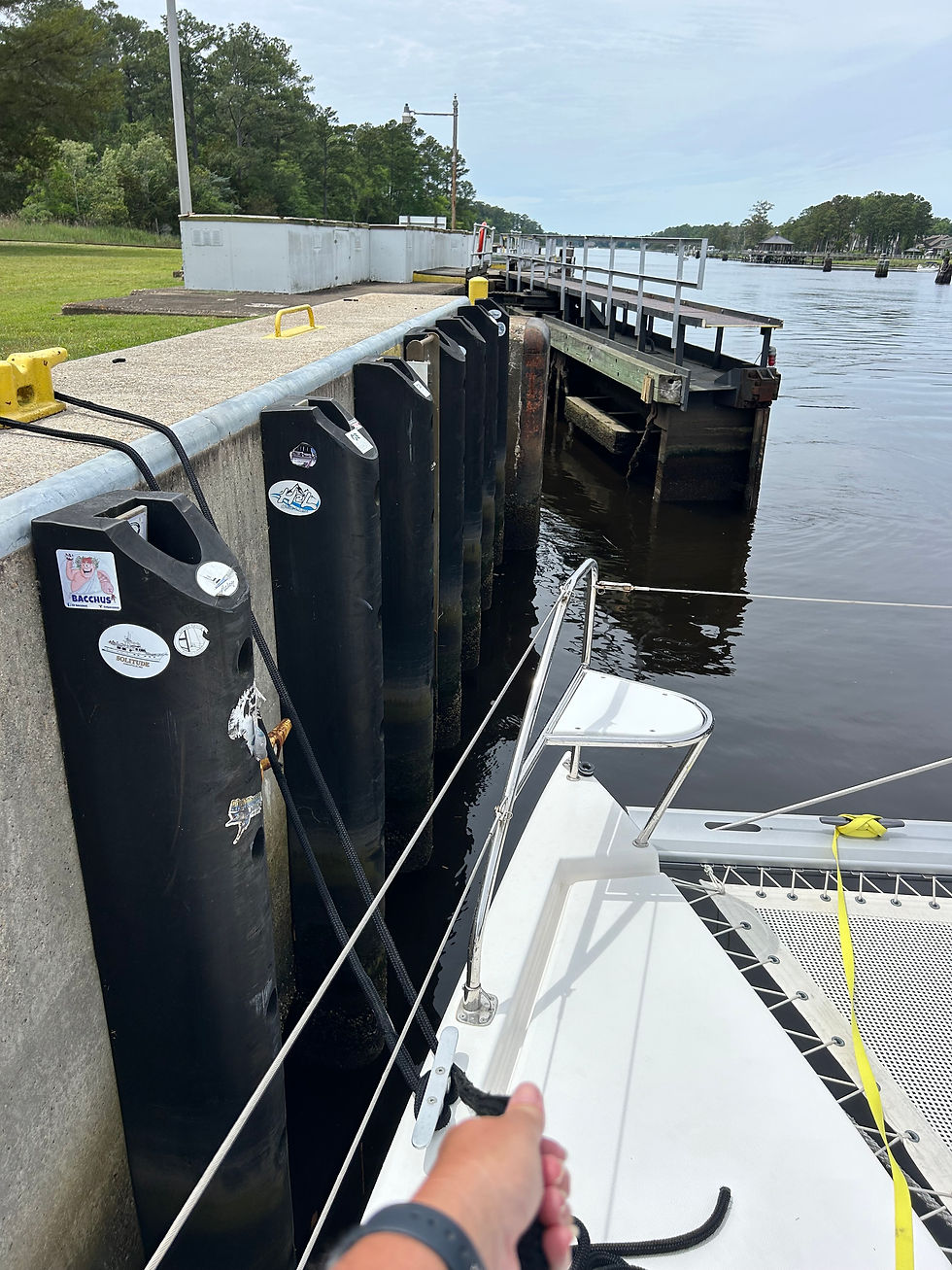
Our First Lock
This journey also marked our first experience with a lock — a system that raises or lowers boats between water levels, like an elevator for vessels. We spent the day preoccupied about it: Which side do we tie up on? Do we need fenders out? Do the tenders help with lines? How strong will the flow be?
Turns out, it was the smoothest part of our day. The water level change was barely two feet, and the transition was gentle. A huge relief and a confidence booster for future lock experiences.
Offshore vs. ICW: The Ongoing Debate
Offshore sailing offers space, simplicity, and a break from bridges. It also means no anchoring — you’re on for 24 hours straight. It’s where our boat feels most at home. But it’s not always safe. Heavy seas and lightning aren’t just uncomfortable — they can be terrifying.
The ICW, on the other hand, provides shelter from wind and waves, and you can stop and anchor for the night. But it’s high-stress navigation with constant obstacles, tight margins, and plenty of unpredictability.
Honestly, I’d rather take a beating offshore than deal with the stress of the ICW. David, however, prefers the hurdles of the ICW when offshore conditions look fierce. It’s an ongoing conversation (and a good balance).
Conclusion: The Captain’s Life
As sailors and captains, we study, plan, monitor, and adapt. And sometimes, we just learn by doing. This ICW passage was a perfect example of that — a test of preparation, communication, and composure under pressure.
We made it through, wiser and more confident for next time. And good thing, too — if we’d waited for the offshore weather window, we might still be sitting in Morehead City.


Comments